
1971 Map of La Belle 4 SW
USGS Topo · Published 1976About this map
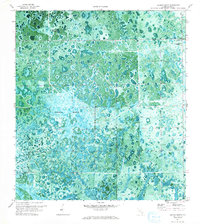
Graham Marsh dominates this orthophotomap of Hendry County, showcasing the intricate wetland patterns of South Florida in the early 1970s. This hybrid topographic-photographic study reveals a landscape defined by seasonal water flow and slightly elevated landforms, most notably the tree island known as Tom Still Hammock. To the west, the winding path of Collins Slough cuts through the marshland, while the eastern edge is marked by the enigmatic Devils Garden. A lone Lookout Tower provides a vertical reference point in this low-lying expanse. The map is particularly useful for understanding the pre-modern drainage and vegetation structure of the region, documenting the interplay between open water, marsh grass, and hardwood hammocks before significant contemporary development altered the natural hydrology.
Find a feature on this map
8 named features on this map. Tap any name to fly to it.
Don’t see what you’re looking for? This feature index may not catch every label — zoom into the map to look around manually.
Map Details
Editions of this 1971 La Belle 4 SW Map
2 editions found
Other maps of this area

1956 · West Palm Beach
USGS Topo · 1:250,000

1957 · West Palm Beach
USGS Topo · 1:250,000

1958 · West Palm Beach
USGS Topo · 1:250,000

1958 · Felda SE
USGS Topo · 1:24,000

1958 · Immokalee NE
USGS Topo · 1:24,000

1958 · Felda NE
USGS Topo · 1:24,000

1970 · La Belle 4 SE
USGS Topo · 1:24,000

1970 · La Belle 4 NW
USGS Topo · 1:24,000

1970 · La Belle 4 NE
USGS Topo · 1:24,000

1974 · Immokalee 1 NE
USGS Topo · 1:24,000