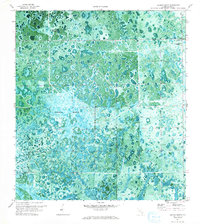
1971 Map of Graham Marsh
USGS Topo · Published 1993About this map
Graham Marsh dominates this 1971 orthophotomosaic, revealing the complex hydrological patterns of the northern Everglades before extensive modern alterations. The combination of aerial photography and topographic data illustrates the intricate mosaic of wet prairies and hardwood heads, such as Tom Still Hammock, that characterize the interior of Hendry County. This specific period of the early 1970s shows the landscape in a state of transition, where established natural features like Collins Slough are punctuated by man-made infrastructure like the Lookout Tower near Devils Garden. The map provides a clear record of the seasonal waterflow and vegetation clusters as they existed prior to further development in south Florida.
Find a feature on this map
8 named features on this map. Tap any name to fly to it.
Don’t see what you’re looking for? This feature index may not catch every label — zoom into the map to look around manually.
Map Details
Editions of this 1971 Graham Marsh Map
2 editions found
Other maps of this area

1956 · West Palm Beach
USGS Topo · 1:250,000

1957 · West Palm Beach
USGS Topo · 1:250,000

1958 · West Palm Beach
USGS Topo · 1:250,000

1958 · Felda SE
USGS Topo · 1:24,000

1958 · Immokalee NE
USGS Topo · 1:24,000

1958 · Felda NE
USGS Topo · 1:24,000

1970 · La Belle 4 SE
USGS Topo · 1:24,000

1970 · La Belle 4 NW
USGS Topo · 1:24,000

1970 · La Belle 4 NE
USGS Topo · 1:24,000

1971 · La Belle 4 SW
USGS Topo · 1:24,000