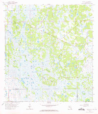
1958 Map of Felda SE
USGS Topo · Published 1972About this map
The vast wetland interior of South Florida's interior is captured here in the late 1950s, revealing a landscape dominated by marshy islands and seasonal drainages along the boundary of Hendry and Collier counties. Human presence is sparse, marked primarily by the Keri Lookout Tower situated along a straight roadway that cuts through the northern section of the sheet. The terrain is a complex network of named hammocks and rises, such as Wild Cow Island, Butterfly Island, and Dog Island, which stand as landmarks within the watery expanse. Narrow channels like Lime Slough and Hooper Slough define the natural flow of water through this wilderness, while an isolated Flowing Well in the east suggests early attempts at land management or agricultural drainage in this remote portion of the Everglades ecosystem.
Find a feature on this map
11 named features on this map. Tap any name to fly to it.
Don’t see what you’re looking for? This feature index may not catch every label — zoom into the map to look around manually.
Map Details
Editions of this 1958 Felda SE Map
2 editions found
Other maps of this area

1956 · West Palm Beach
USGS Topo · 1:250,000

1957 · West Palm Beach
USGS Topo · 1:250,000

1958 · West Palm Beach
USGS Topo · 1:250,000

1958 · Felda SE
USGS Topo · 1:24,000

1958 · Immokalee
USGS Topo · 1:24,000

1958 · Felda
USGS Topo · 1:24,000

1958 · Immokalee NE
USGS Topo · 1:24,000

1958 · Felda NE
USGS Topo · 1:24,000

1958 · Sears
USGS Topo · 1:24,000

1970 · La Belle 4 NW
USGS Topo · 1:24,000