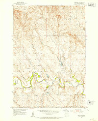
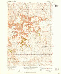
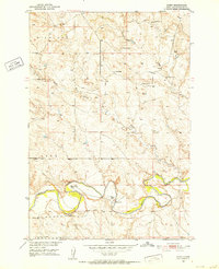
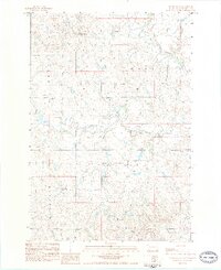
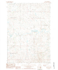
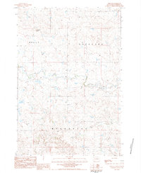
1951 Map of Imogene
USGS Topo · Published 1953About this map
Moreau River meanders through this western South Dakota landscape, shaping the development of Perkins County during the early 1950s. The region is characterized by a network of seasonal drainages and creek beds, including Cottonwood Creek and Brushy Creek, which feed into the main river valley. Small-scale agricultural and ranching operations are documented through landmarks like Stillwell Ranch and Nelson Farm, while the presence of School No 73 highlights the era's rural community structure.
Find a feature on this map
24 named features on this map. Tap any name to fly to it.
Don’t see what you’re looking for? This feature index may not catch every label — zoom into the map to look around manually.
Map Details
Editions of this 1951 Imogene Map
This is the sole edition of this map. No revisions or reprints were ever made.
Other maps of this area
1951 · Cedar Canyon
USGS Topo · 1:24,000

1951 · Maurine
USGS Topo · 1:24,000
1951 · Bixby
USGS Topo · 1:24,000

1954 · Lemmon
USGS Topo · 1:250,000

1957 · Lemmon
USGS Topo · 1:250,000

1980 · Beverly Creek
USGS Topo · 1:25,000
1980 · Zeona
USGS Topo · 1:25,000
1983 · Rabbit Butte
USGS Topo · 1:24,000
1983 · Date
USGS Topo · 1:24,000
1983 · Sorum SE
USGS Topo · 1:24,000