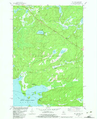
1982 Map of Imp Lake
USGS Topo · Published 1983About this map
Katakitekon Indian Village and its associated Cem occupy a significant site on the northern shore of Lac Vieux Desert, where the landscape transitions from the Ottawa National Forest in Michigan into the Nicolet National Forest of Wisconsin. This survey, compiled from information provided by the Michigan Department of Natural Resources, reveals a dense network of water features including Imp Lake, Stone Lake, and Muskey Lake.
Find a feature on this map
43 named features on this map. Tap any name to fly to it.
Don’t see what you’re looking for? This feature index may not catch every label — zoom into the map to look around manually.
Map Details
Editions of this 1982 Imp Lake Map
This is the sole edition of this map. No revisions or reprints were ever made.
Other maps of this area

1938 · Phelps
USGS Topo · 1:48,000

1950 · Phelps
USGS Topo · 1:48,000

1952 · Watersmeet
USGS Topo · 1:62,500

1954 · Kenton
USGS Topo · 1:62,500

1956 · Beechwood
USGS Topo · 1:62,500

1956 · Phelps
USGS Topo · 1:62,500

1958 · Iron River
USGS Topo · 1:250,000

1960 · Iron River
USGS Topo · 1:250,000

1961 · Iron River
USGS Topo · 1:250,000

1967 · Iron River
USGS Topo · 1:250,000