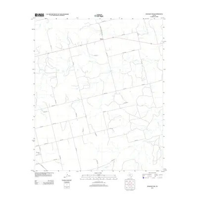
2012 Map of Inadale NW
USGS Topo · Published 2012About this map
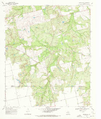
Midway stands as a focal point in this West Texas landscape, situated along the intersection of major county routes and S Farm-To-Market Road 1614. The terrain is defined by the winding course of the Clear Fork and its tributaries, including Buffalo Cr and Camp Cr. This 2012 survey illustrates a region largely characterized by its rural infrastructure, where an extensive network of county roads like Co RD-1121 and Co RD-4102 connects scattered homesteads and agricultural tracts. For those tracing local history or genealogy, the presence of the Hermleigh Cem in the southwestern corner and named locales such as Greene Springs and Green Spring? offer specific points of interest. The map captures the quiet, organized layout of Scurry County's ranching and farming lands in the early 21st century.
Find a feature on this map
33 named features on this map. Tap any name to fly to it.
Don’t see what you’re looking for? This feature index may not catch every label — zoom into the map to look around manually.
Map Details
Editions of this 2012 Inadale NW Map
This is the sole edition of this map. No revisions or reprints were ever made.
Other maps of this area
1932 · Camp Springs
USGS Topo · 1:62,500
1952 · China Grove
USGS Topo · 1:24,000
1952 · Hermleigh
USGS Topo · 1:24,000
1954 · Lloyd Mountain
USGS Topo · 1:24,000

1954 · Big Spring
USGS Topo · 1:250,000

1958 · Big Spring
USGS Topo · 1:250,000
1969 · Camp Springs
USGS Topo · 1:24,000
1969 · Bull Creek
USGS Topo · 1:24,000
1969 · Inadale NW
USGS Topo · 1:24,000
1969 · Bernecker
USGS Topo · 1:24,000