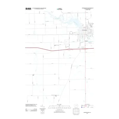
2013 Map of Independence
USGS Topo · Published 2013About this map
The Wapsipinicon River creates a winding natural spine through this Buchanan County landscape, defining the layout of Independence as it flows beneath the Wapsipinicon River Bridge. The city serves as a regional hub, evidenced by its grid of established streets such as 1st St E and 3rd St NW, alongside recreational and civic anchors like the Buchanan County Fairgrounds and the Independence Motor Speedway.
Find a feature on this map
78 named features on this map. Tap any name to fly to it.
Don’t see what you’re looking for? This feature index may not catch every label — zoom into the map to look around manually.
Map Details
Editions of this 2013 Independence Map
This is the sole edition of this map. No revisions or reprints were ever made.
Other maps of this area

1901 · Oelwein
USGS Topo · 1:125,000

1903 · Winthrop
USGS Topo · 1:125,000

1954 · Waterloo
USGS Topo · 1:250,000

1955 · Waterloo
USGS Topo · 1:250,000

1959 · Dubuque
USGS Topo · 1:250,000

1961 · Dubuque
USGS Topo · 1:250,000

1962 · Dubuque
USGS Topo · 1:250,000
1971 · Brandon
USGS Topo · 1:24,000

1971 · Littleton
USGS Topo · 1:24,000
1971 · Jesup
USGS Topo · 1:24,000