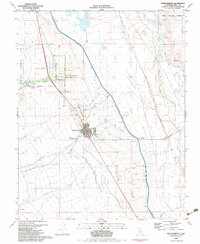
1982 Map of Independence
USGS Topo · Published 1983About this map
The town of Independence serves as the focal point of this Eastern Sierra landscape, situated where the valley floor meets the eastern slopes of the Sierra Nevada. The proximity of the Los Angeles Aqueduct and the Owens River illustrates the region's complex water history, with the massive canal cutting a straight line across the alluvial fans. To the north, the Fort Independence Indian Reservation and the historic Mt Whitney Fish Hatchery mark long-standing land uses. Local history is deeply etched into the terrain through several burial grounds, including the Old Independence Cem, Indian Cem, and the primary Independence Cemetery. The map also reveals remnants of regional transportation, such as an Old Railroad Grade and the route of Onion Valley Road heading west into the mountains.
Find a feature on this map
38 named features on this map. Tap any name to fly to it.
Don’t see what you’re looking for? This feature index may not catch every label — zoom into the map to look around manually.
Map Details
Editions of this 1982 Independence Map
2 editions found
Other maps of this area

1907 · Mt. Whitney
USGS Topo · 1:125,000

1919 · Mt. Whitney
USGS Topo · 1:125,000

1937 · Mt. Whitney
USGS Topo · 1:125,000

1948 · Fresno
USGS Topo · 1:250,000

1951 · Independence
USGS Topo · 1:62,500

1953 · Mt. Pinchot
USGS Topo · 1:62,500

1955 · Fresno
USGS Topo · 1:250,000

1956 · Fresno
USGS Topo · 1:250,000

1956 · Mount Whitney
USGS Topo · 1:62,500

1958 · Fresno
USGS Topo · 1:250,000