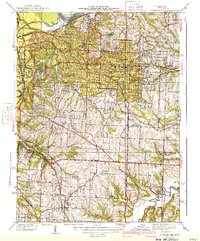
1940 Map of Independence
USGS Topo · Published 1940About this map
Independence sits at the heart of this 1930s landscape, serving as a hub where numerous rail lines like the Alton and Missouri Pacific converge. The survey illustrates a dense network of suburban growth extending westward toward Mt Washington and Englewood, with neighborhoods characterized by established institutions including the Sanitarium and the Court House. To the north, the terrain drops toward the industrial corridor of Sugar Creek near the Missouri River, while the southern reaches near Raytown retain a more rural character defined by family-named schools like Pitcher Sch and Whiteoak Sch.
Find a feature on this map
60 named features on this map. Tap any name to fly to it.
Don’t see what you’re looking for? This feature index may not catch every label — zoom into the map to look around manually.
Map Details
Editions of this 1940 Independence Map
2 editions found
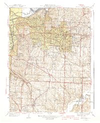
Other maps of this area

1887 · Harrisonville
USGS Topo · 1:125,000

1887 · Olathe
USGS Topo · 1:125,000

1890 · Kansas City
USGS Topo · 1:125,000

1892 · Harrisonville
USGS Topo · 1:125,000

1893 · Olathe
USGS Topo · 1:125,000

1894 · Kansas City
USGS Topo · 1:125,000

1894 · Harrisonville
USGS Topo · 1:125,000

1894 · Independence
USGS Topo · 1:125,000

1933 · Blue Springs
USGS Topo · 1:24,000

1934 · Independence
USGS Topo · 1:24,000