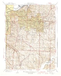
1940 Map of Independence
USGS Topo · Published 1940About this map
Independence serves as a dense municipal hub just east of the Missouri River bend, showing a landscape transitioning from suburban grid to agricultural ridges in the years before the second World War. The map details a heavy concentration of social and civic infrastructure, including the Sanitarium, Girls Home, and the Kansas City Tubercular Hospital. The rail network is particularly intricate here, with the Alton RR, Kansas City Southern, and Missouri Pacific converging near the industrial corridor of Sugar Creek.
Find a feature on this map
68 named features on this map. Tap any name to fly to it.
Don’t see what you’re looking for? This feature index may not catch every label — zoom into the map to look around manually.
Map Details
Editions of this 1940 Independence Map
2 editions found
Other maps of this area

1887 · Harrisonville
USGS Topo · 1:125,000

1887 · Olathe
USGS Topo · 1:125,000

1890 · Kansas City
USGS Topo · 1:125,000

1892 · Harrisonville
USGS Topo · 1:125,000

1893 · Olathe
USGS Topo · 1:125,000

1894 · Kansas City
USGS Topo · 1:125,000

1894 · Harrisonville
USGS Topo · 1:125,000

1894 · Independence
USGS Topo · 1:125,000

1933 · Blue Springs
USGS Topo · 1:24,000

1934 · Independence
USGS Topo · 1:24,000