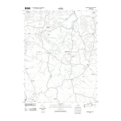
2010 Map of Independence
USGS Topo · Published 2010About this map
The city of Independence serves as a central hub in this Kenton County landscape, situated at the confluence of several local thoroughfares including Independence Rd and Madison Pike. The area is defined by its numerous small settlements and family-oriented landmarks, such as Ricedale, Bank Lick, and Nicholson. A significant number of burial sites are documented across the terrain, from larger facilities like Floral Hills Memorial Gardens to smaller, localized plots such as Rector Cemetery and Hoffman Cemetery.
Find a feature on this map
77 named features on this map. Tap any name to fly to it.
Don’t see what you’re looking for? This feature index may not catch every label — zoom into the map to look around manually.
Map Details
Editions of this 2010 Independence Map
This is the sole edition of this map. No revisions or reprints were ever made.
Other maps of this area

1898 · East Cincinnati
USGS Topo · 1:62,500

1914 · East Cincinnati
USGS Topo · 1:62,500

1914 · West Cincinnati
USGS Topo · 1:62,500

1929 · Alexandria
USGS Topo · 1:48,000

1936 · Alexandria
USGS Topo · 1:62,500

1950 · Union
USGS Topo · 1:24,000

1950 · Independence
USGS Topo · 1:24,000

1950 · Verona
USGS Topo · 1:24,000

1950 · Walton
USGS Topo · 1:24,000

1950 · Covington
USGS Topo · 1:24,000