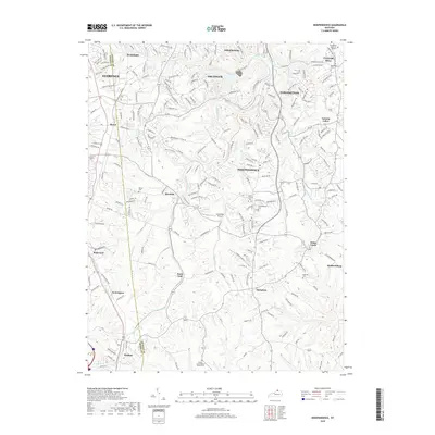
2019 Map of Independence
USGS Topo · Published 2019About this map
The suburban and rural transitions of Kenton County are documented here, centered on the community of Independence. The terrain is defined by the winding paths of Banklick Creek and Bullock Pen Creek, which carve through the landscape between rising ridges. Local infrastructure includes the Caintuckee Airport and numerous historical burial grounds such as Independence Cem and Rector Cem. Smaller, distinct settlements like Ricedale, Staffordsburg, and White Tower are mapped alongside the expanding residential footprints of Taylor Mill and Erlanger. This survey captures the complex drainage systems of the Brushy Fork and Fowler Cr, illustrating how the area’s topography has influenced the placement of both historic homesteads and modern developments.
Find a feature on this map
199 named features on this map. Tap any name to fly to it.
Don’t see what you’re looking for? This feature index may not catch every label — zoom into the map to look around manually.
Map Details
Editions of this 2019 Independence Map
This is the sole edition of this map. No revisions or reprints were ever made.
Other maps of this area

1898 · East Cincinnati
USGS Topo · 1:62,500

1914 · East Cincinnati
USGS Topo · 1:62,500

1914 · West Cincinnati
USGS Topo · 1:62,500

1929 · Alexandria
USGS Topo · 1:48,000

1936 · Alexandria
USGS Topo · 1:62,500

1950 · Union
USGS Topo · 1:24,000

1950 · Independence
USGS Topo · 1:24,000

1950 · Verona
USGS Topo · 1:24,000

1950 · Walton
USGS Topo · 1:24,000

1950 · Covington
USGS Topo · 1:24,000