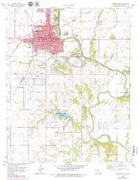
1959 Map of Independence
USGS Topo · Published 1979About this map
Independence serves as a major hub for the region at the close of the 1950s, defined by its grid of schools like Lincoln Sch and Washington Sch and its dual rail access via the Missouri Pacific and Atchison Topeka and Santa Fe lines. The urban landscape transitions northward into the recreational grounds of Riverside Park and several prominent burial sites, including Mount Hope Cem and Calvary Cem. To the south, the settlement of Fruitland sits near the Independence Community College campus, illustrating the mid-century expansion of local institutions.
Find a feature on this map
42 named features on this map. Tap any name to fly to it.
Don’t see what you’re looking for? This feature index may not catch every label — zoom into the map to look around manually.
Map Details
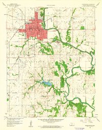
Editions of this 1959 Independence Map
2 editions found
Other maps of this area

1886 · Independence
USGS Topo · 1:125,000

1894 · Independence
USGS Topo · 1:125,000

1905 · Independence
USGS Topo · 1:125,000

1947 · Joplin
USGS Topo · 1:250,000

1949 · Joplin
USGS Topo · 1:250,000

1954 · Joplin
USGS Topo · 1:250,000

1958 · Joplin
USGS Topo · 1:250,000
1959 · Tyro
USGS Topo · 1:24,000

1959 · Joplin
USGS Topo · 1:250,000
1959 · Bolton
USGS Topo · 1:24,000