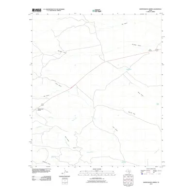
2010 Map of Independence Spring
USGS Topo · Published 2010About this map
Nickel Creek Station and the D Ranch anchor this West Texas landscape, where the ephemeral drainage of the Delaware River carves through Culberson County. The map captures a transition from the winding depths of Mc Kittrick Canyon and Lamar Canyon to the more open draws and tanks to the east. Water management is a primary theme of the terrain, visible through features like North Windmill, Seep Tank, and Clay Tank, which sustained ranching operations in this arid environment. The road network is sparse, centered on McKittrick Rd and the main highway route through the canyons. This 2010 survey reflects a period when the infrastructure of long-standing cattle ranches intersected with the natural geography of the Guadalupe Mountains foothills, preserving the names of localized landmarks like Independence Spring and Well Drill Draw.
Find a feature on this map
26 named features on this map. Tap any name to fly to it.
Don’t see what you’re looking for? This feature index may not catch every label — zoom into the map to look around manually.
Map Details
Editions of this 2010 Independence Spring Map
This is the sole edition of this map. No revisions or reprints were ever made.
Other maps of this area

1933 · Guadalupe Peak
USGS Topo · 1:48,000

1935 · El Paso Gap
USGS Topo · 1:62,500

1936 · El Paso Gap
USGS Topo · 1:48,000

1940 · El Paso Gap
USGS Topo · 1:62,500

1940 · Guadalupe Peak
USGS Topo · 1:62,500

1940 · Carlsbad Caverns West
USGS Topo · 1:62,500

1943 · Carlsbad Caverns West
USGS Topo · 1:62,500

1954 · Carlsbad
USGS Topo · 1:250,000

1954 · Van Horn
USGS Topo · 1:250,000

1958 · Van Horn
USGS Topo · 1:250,000