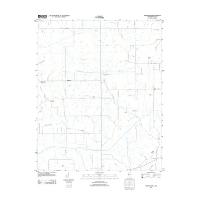
2012 Map of Independence
USGS Topo · Published 2012About this map
Independence serves as the central hub of this northern Mississippi landscape, where rural life is defined by a dense network of family cemeteries and winding creek branches. Genealogists will find significant value in the distribution of burial sites like Mount Zion Cem, Fredonia Cem, and Jamison Cem, which are scattered throughout the agricultural plots. The terrain is deeply etched by watercourses, most notably the Hickahala Cr and its various tributaries including Buttermilk Cr and Lick Br Cr. Small crossroads settlements such as Lurline, Poagville, and Thyatira mark the transition between fields and timbered areas. This 2012 survey documents the modern layout of Tate County, including the location of Williams Field Airport and the expansive Sunset Memorial Garden near the southern boundary.
Find a feature on this map
81 named features on this map. Tap any name to fly to it.
Don’t see what you’re looking for? This feature index may not catch every label — zoom into the map to look around manually.
Map Details
Editions of this 2012 Independence Map
This is the sole edition of this map. No revisions or reprints were ever made.
Other maps of this area

1944 · Senatobia
USGS Topo · 1:62,500

1944 · Hernando
USGS Topo · 1:62,500

1944 · Tyro
USGS Topo · 1:62,500

1948 · Byhalia
USGS Topo · 1:62,500

1956 · Tupelo
USGS Topo · 1:250,000

1958 · Tupelo
USGS Topo · 1:250,000
1971 · Byhalia
USGS Topo · 1:24,000

1971 · Wyatte
USGS Topo · 1:24,000
1971 · Tyro
USGS Topo · 1:24,000
1975 · Senatobia SW
USGS Topo · 1:24,000