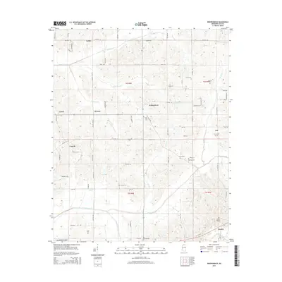
2015 Map of Independence
USGS Topo · Published 2015About this map
Lurline and Independence anchor a rural landscape in northern Mississippi defined by a dense network of country cemeteries and meandering watercourses. The terrain is deeply inscribed with family and local history, evidenced by burial grounds such as Mount Zion Cem, Hancock Cem, and Sandridge Cem. Small communities like Poagville, Bett, and Thyatira are linked by winding roads that follow the ridges between drainages. Significant hydrological features include Hickahala Creek in the south and the James Wolf Canal, which represent the natural and managed water systems of the region. This 2015 data reflects the enduring settlement patterns of Tate County, where isolated landmarks like Williams Field and Senatobia Lakes stand alongside established agricultural crossroads such as Antioch and Bowman.
Find a feature on this map
80 named features on this map. Tap any name to fly to it.
Don’t see what you’re looking for? This feature index may not catch every label — zoom into the map to look around manually.
Map Details
Editions of this 2015 Independence Map
This is the sole edition of this map. No revisions or reprints were ever made.
Other maps of this area

1944 · Senatobia
USGS Topo · 1:62,500

1944 · Hernando
USGS Topo · 1:62,500

1944 · Tyro
USGS Topo · 1:62,500

1948 · Byhalia
USGS Topo · 1:62,500

1956 · Tupelo
USGS Topo · 1:250,000

1958 · Tupelo
USGS Topo · 1:250,000
1971 · Byhalia
USGS Topo · 1:24,000

1971 · Wyatte
USGS Topo · 1:24,000
1971 · Tyro
USGS Topo · 1:24,000
1975 · Senatobia SW
USGS Topo · 1:24,000