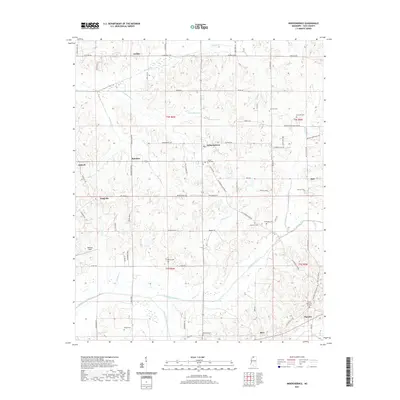
2021 Map of Independence
USGS Topo · Published 2021About this map
Independence serves as the central hub of this Tate County landscape, where rural communities are connected by a network of historic routes like the Old Memphis Oxford Rd. The settlement pattern is defined by family-named localities and numerous small cemeteries, such as Mount Zion Cem and Burford Cem, which offer significant value for genealogical research in this part of Mississippi.
Find a feature on this map
82 named features on this map. Tap any name to fly to it.
Don’t see what you’re looking for? This feature index may not catch every label — zoom into the map to look around manually.
Map Details
Editions of this 2021 Independence Map
This is the sole edition of this map. No revisions or reprints were ever made.
Other maps of this area

1944 · Senatobia
USGS Topo · 1:62,500

1944 · Hernando
USGS Topo · 1:62,500

1944 · Tyro
USGS Topo · 1:62,500

1948 · Byhalia
USGS Topo · 1:62,500

1956 · Tupelo
USGS Topo · 1:250,000

1958 · Tupelo
USGS Topo · 1:250,000
1971 · Byhalia
USGS Topo · 1:24,000

1971 · Wyatte
USGS Topo · 1:24,000
1971 · Tyro
USGS Topo · 1:24,000
1975 · Senatobia SW
USGS Topo · 1:24,000