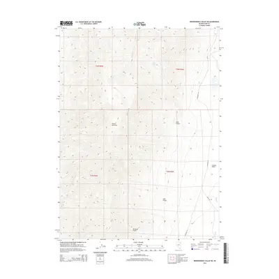
2014 Map of Independence Valley NE
USGS Topo · Published 2014About this map
California Trl cuts across the high desert terrain of eastern Elko County, tracing a historic path of westward migration through the Great Basin. This modern survey illustrates the persistent imprint of this overland route as it skirts the eastern edge of the Pequop Mountains before descending toward the Goshute Valley. The landscape is defined by its seasonal hydrology, with drainage features like Sixmile Cr and Hardy Cr providing critical water sources in an arid environment. Notable landmarks such as Long Canyon Spring and Big Springs highlight the points of reliability for travelers and livestock alike. The map also records later access routes like the Hardy Crk Trl, which navigate the steep elevations of Spud Canyon and Mahogany Canyon.
Find a feature on this map
15 named features on this map. Tap any name to fly to it.
Don’t see what you’re looking for? This feature index may not catch every label — zoom into the map to look around manually.
Map Details
Editions of this 2014 Independence Valley NE Map
This is the sole edition of this map. No revisions or reprints were ever made.
Other maps of this area

1955 · Wells
USGS Topo · 1:250,000

1955 · Elko
USGS Topo · 1:250,000

1958 · Wells
USGS Topo · 1:250,000

1958 · Elko
USGS Topo · 1:250,000

1961 · Wells
USGS Topo · 1:250,000

1962 · Elko
USGS Topo · 1:250,000

1965 · Elko
USGS Topo · 1:250,000
1967 · Cobre
USGS Topo · 1:24,000
1968 · Independence Valley NE
USGS Topo · 1:24,000
1968 · Independence Valley SW
USGS Topo · 1:24,000