
1968 Map of Independence Valley NE
USGS Topo · Published 1971About this map
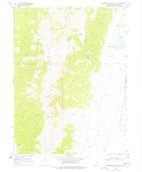
The Pequop Mountains dominate the western half of this Nevada landscape, transitioning sharply into the broad expanse of the Goshute Valley (Depression) to the east. At the edge of the mountains, the Big Springs Ranch sits near the namesake Big Springs, highlighting the essential role of water in this high-desert environment. Evidence of human activity and exploration is scattered throughout the terrain, from a Well on the valley floor to several Prospects and a Prospect located within the higher elevations. Drainage patterns are defined by features such as Sixmile Creek and the ephemeral Hardy Creek. Remote access is indicated by various Jeep Trails that navigate the slopes of Long Canyon and the valley periphery, while the presence of a Borrow Pit suggests localized material extraction for road maintenance or ranching needs during the late 1960s.
Find a feature on this map
15 named features on this map. Tap any name to fly to it.
Don’t see what you’re looking for? This feature index may not catch every label — zoom into the map to look around manually.
Map Details
Editions of this 1968 Independence Valley NE Map
2 editions found
Other maps of this area

1955 · Wells
USGS Topo · 1:250,000

1955 · Elko
USGS Topo · 1:250,000

1958 · Wells
USGS Topo · 1:250,000

1958 · Elko
USGS Topo · 1:250,000

1961 · Wells
USGS Topo · 1:250,000

1962 · Elko
USGS Topo · 1:250,000

1965 · Elko
USGS Topo · 1:250,000

1967 · Cobre
USGS Topo · 1:24,000

1968 · Independence Valley SW
USGS Topo · 1:24,000
1968 · Pequop Summit SW
USGS Topo · 1:24,000