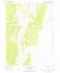
1968 Map of Independence Valley NE
USGS Topo · Published 1978About this map
The Pequop Mountains dominate this high-desert landscape in northeastern Nevada, dividing the sheet with a series of peaks and drainages like Sixmile Creek and Long Canyon. In the eastern half of the quadrangle, the terrain drops away into the Goshute Valley (Depression), where water sources become vital focal points for the sparse human presence in the area. Evidence of ranching and early resource extraction is visible through the Big Springs Ranch and various Prospects and a Borrow Pit scattered across the slopes. This 1968 field-checked survey highlights a period when the vast basin-and-range country was navigated primarily by Jeep Trails, connecting remote locations such as South Pequop and Long Canyon Spring to the seasonal flow of Hardy Creek.
Find a feature on this map
17 named features on this map. Tap any name to fly to it.
Don’t see what you’re looking for? This feature index may not catch every label — zoom into the map to look around manually.
Map Details
Editions of this 1968 Independence Valley NE Map
2 editions found
Other maps of this area

1955 · Wells
USGS Topo · 1:250,000

1955 · Elko
USGS Topo · 1:250,000

1958 · Wells
USGS Topo · 1:250,000

1958 · Elko
USGS Topo · 1:250,000

1961 · Wells
USGS Topo · 1:250,000

1962 · Elko
USGS Topo · 1:250,000

1965 · Elko
USGS Topo · 1:250,000

1967 · Cobre
USGS Topo · 1:24,000

1968 · Independence Valley NE
USGS Topo · 1:24,000

1968 · Independence Valley SW
USGS Topo · 1:24,000