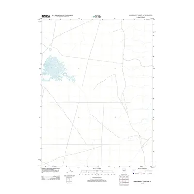
2012 Map of Independence Valley NW
USGS Topo · Published 2012About this map
Ralphs Warm Spring serves as the primary hydrological landmark in this high-desert region of Elko County. The landscape is defined by an intricate network of ephemeral drainages and unimproved roads, reflecting the vast, open character of Nevada's interior basins in the early twenty-first century. Unlike more developed quadrangles, this area maintains a sparse infrastructure where water sources like Ralphs Warm Spring are critical focal points for land use and ranching operations. The rectilinear grid of the township and range system is clearly visible, providing a framework for the few local roads that cross the valley floor to connect remote outposts.
Find a feature on this map
1 named feature on this map. Tap any name to fly to it.
Don’t see what you’re looking for? This feature index may not catch every label — zoom into the map to look around manually.
Map Details
Editions of this 2012 Independence Valley NW Map
This is the sole edition of this map. No revisions or reprints were ever made.
Other maps of this area

1955 · Wells
USGS Topo · 1:250,000

1955 · Elko
USGS Topo · 1:250,000

1958 · Wells
USGS Topo · 1:250,000

1958 · Elko
USGS Topo · 1:250,000

1961 · Wells
USGS Topo · 1:250,000

1962 · Elko
USGS Topo · 1:250,000

1965 · Elko
USGS Topo · 1:250,000
1968 · Moor Summit
USGS Topo · 1:24,000
1968 · Independence Valley NE
USGS Topo · 1:24,000
1968 · Independence Valley SW
USGS Topo · 1:24,000