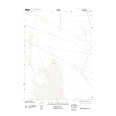
2012 Map of Independence Valley SW
USGS Topo · Published 2012About this map
Independence Valley dominates this high-altitude landscape of eastern Nevada, where the vast desert floor meets the rising slopes of the Pequop Mountains. This 2012 survey highlights a region shaped by transport and small outposts, specifically Spruce and Rockland, which sit on the valley's edge. The presence of the RR Maint Rd cutting through the center of the sheet reflects the ongoing importance of the rail corridor in maintaining connectivity across the Great Basin. This map provides a clear view of the sparse human footprint in a region where settlement is dictated by the availability of water and the paths of the iron horse, offering researchers a look at how these tiny localities remained as points on the map into the 21st century.
Find a feature on this map
4 named features on this map. Tap any name to fly to it.
Don’t see what you’re looking for? This feature index may not catch every label — zoom into the map to look around manually.
Map Details
Editions of this 2012 Independence Valley SW Map
This is the sole edition of this map. No revisions or reprints were ever made.
Other maps of this area

1953 · Spruce Mountain
USGS Topo · 1:62,500

1953 · Spruce Mountain 4
USGS Topo · 1:62,500

1955 · Elko
USGS Topo · 1:250,000

1958 · Elko
USGS Topo · 1:250,000

1962 · Elko
USGS Topo · 1:250,000

1965 · Elko
USGS Topo · 1:250,000

1968 · Independence Valley NE
USGS Topo · 1:24,000

1968 · Independence Valley SW
USGS Topo · 1:24,000

1968 · Ventosa
USGS Topo · 1:24,000
1968 · Snow Water Lake NE
USGS Topo · 1:24,000