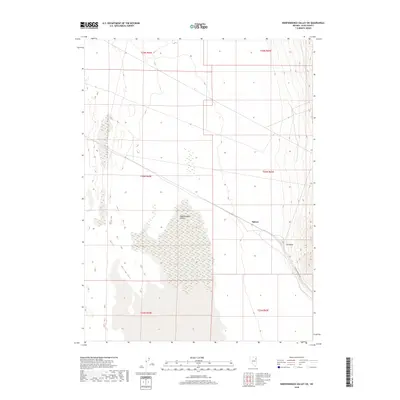
2018 Map of Independence Valley SW
USGS Topo · Published 2018About this map
Independence Valley dominates this high-altitude landscape in eastern Nevada, characterized by an expansive drainage basin surrounded by rising terrain. The map captures a corridor of transportation and small-scale settlement along the eastern edge of the valley, where Spruce and Rockland are located. These points of interest are situated near the foot of the mountains, illustrating how historical habitation in this part of Elko County followed the accessible fringes of the basin floors. A primary transit artery, identified as the RR Maintenance Rd, runs parallel to the topographic contours, serving as a critical infrastructure link through this sparsely populated region. The geography here is defined by the sharp transition from the level valley floor to the steep inclines of the neighboring ranges, a pattern typical of the Great Basin's land management and settlement history.
Find a feature on this map
10 named features on this map. Tap any name to fly to it.
Don’t see what you’re looking for? This feature index may not catch every label — zoom into the map to look around manually.
Map Details
Editions of this 2018 Independence Valley SW Map
This is the sole edition of this map. No revisions or reprints were ever made.
Other maps of this area

1953 · Spruce Mountain
USGS Topo · 1:62,500

1953 · Spruce Mountain 4
USGS Topo · 1:62,500

1955 · Elko
USGS Topo · 1:250,000

1958 · Elko
USGS Topo · 1:250,000

1962 · Elko
USGS Topo · 1:250,000

1965 · Elko
USGS Topo · 1:250,000

1968 · Independence Valley NE
USGS Topo · 1:24,000

1968 · Independence Valley SW
USGS Topo · 1:24,000

1968 · Ventosa
USGS Topo · 1:24,000
1968 · Snow Water Lake NE
USGS Topo · 1:24,000