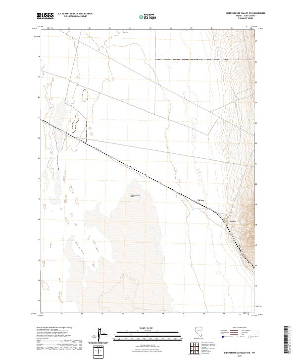
2021 Map of Independence Valley SW
USGS Topo · Published 2021About this map
Independence Valley dominates this Elko County landscape, where the vast, low-lying floor meets the rising slopes of the Pequop Mountains to the east. This modern survey illustrates the persistent imprint of historical settlement and transportation in this high-desert basin. The presence of Spruce and Rockland on the eastern edge points to the region's enduring mining and ranching heritage, situated where the valley floor transitions into the more varied terrain of the upland. A prominent line of transit is established by the RR Maintenance Rd, which cuts across the landscape, following a legacy rail corridor that has shaped movement through the valley for over a century. The gridded township lines, including t34n r64e and t35n r65e, provide a structured view of land management and property division in this characteristic corner of the Great Basin.
Find a feature on this map
11 named features on this map. Tap any name to fly to it.
Don’t see what you’re looking for? This feature index may not catch every label — zoom into the map to look around manually.
Map Details
Editions of this 2021 Independence Valley SW Map
This is the sole edition of this map. No revisions or reprints were ever made.
Other maps of this area

1953 · Spruce Mountain
USGS Topo · 1:62,500

1953 · Spruce Mountain 4
USGS Topo · 1:62,500

1955 · Elko
USGS Topo · 1:250,000

1958 · Elko
USGS Topo · 1:250,000

1962 · Elko
USGS Topo · 1:250,000

1965 · Elko
USGS Topo · 1:250,000

1968 · Independence Valley NE
USGS Topo · 1:24,000

1968 · Independence Valley SW
USGS Topo · 1:24,000

1968 · Ventosa
USGS Topo · 1:24,000
1968 · Snow Water Lake NE
USGS Topo · 1:24,000