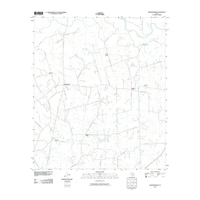
2010 Map of Independence
USGS Topo · Published 2010About this map
Independence serves as the focal point of this rural Washington County landscape, where the historic La Bahia Trl E cuts across the terrain as a reminder of early Texas transit. The area is defined by its deep roots in agricultural and settlement history, evidenced by family-named landmarks and historical burial grounds such as Independence Cemetery, Summers Cemetery, and Good Hope Cemetery. To the northeast, the Brazos River snakes through the coastal plain, joined by tributaries like Yegua Creek and Coles Creek. Local infrastructure reflects a mix of traditional ranching and modern utility, with small private airstrips like the Flying C Ranch Airport and Faust Farm Airport scattered among the large landholdings. Roads such as Seward Plantation Rd and Sam Houston Rd link the small communities of William Penn and Sandy Hill, preserving the names of the figures who shaped the region's development.
Find a feature on this map
55 named features on this map. Tap any name to fly to it.
Don’t see what you’re looking for? This feature index may not catch every label — zoom into the map to look around manually.
Map Details
Editions of this 2010 Independence Map
This is the sole edition of this map. No revisions or reprints were ever made.
Other maps of this area

1913 · Millican
USGS Topo · 1:31,680

1914 · Gay Hill
USGS Topo · 1:62,500

1914 · Navasota
USGS Topo · 1:62,500

1930 · Brenham
USGS Topo · 1:62,500

1954 · Austin
USGS Topo · 1:250,000

1956 · Hempstead
USGS Topo · 1:62,500

1956 · Brenham
USGS Topo · 1:62,500

1958 · Washington
USGS Topo · 1:24,000

1959 · Millican
USGS Topo · 1:24,000

1959 · Gay Hill
USGS Topo · 1:24,000