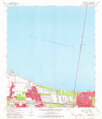
1965 Map of Indian Beach
USGS Topo · Published 1966About this map
Lake Pontchartrain dominates the northern half of this mid-1960s survey, defined by the long reach of the Lake Pontchartrain Causeway (Toll) stretching toward the horizon. The shoreline is protected by a continuous levee system, behind which a dense network of suburban developments and drainage infrastructure manages the low-lying terrain of Jefferson Parish. Numerous pumping stations, such as Pumping Station No 2 and Pumping Sta No 4, are critical fixtures of this landscape, linked by a series of numbered canals including Canal No 11 and Canal No 2.
Find a feature on this map
42 named features on this map. Tap any name to fly to it.
Don’t see what you’re looking for? This feature index may not catch every label — zoom into the map to look around manually.
Map Details
Editions of this 1965 Indian Beach Map
4 editions found
Other maps of this area

1891 · Hahnville
USGS Topo · 1:62,500

1891 · Spanish Fort
USGS Topo · 1:62,500

1891 · New Orleans
USGS Topo · 1:62,500

1892 · Bonnet Carre
USGS Topo · 1:62,500

1932 · New Orleans NE
USGS Topo · 1:31,680

1932 · New Orleans NW
USGS Topo · 1:31,680

1932 · Hahnville NE
USGS Topo · 1:31,680

1935 · Luling
USGS Topo · 1:31,680

1936 · Bonnet Carre
USGS Topo · 1:62,500

1936 · Spanish Fort
USGS Topo · 1:62,500