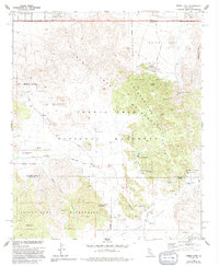
1972 Map of Indian Cove
USGS Topo · Published 1994About this map
Joshua Tree National Monument dominates this desert landscape, revealing a complex network of ranching and mining history within the Wonderland of Rocks. The mapping shows the established Keys Ranch and nearby industrial remains at Wall Street Mill, indicating a period where small-scale desert operations persisted alongside conservation efforts. To the north, the residential edge of Panorama Heights meets the protected boundary, while the interior is marked by cattle-era infrastructure like Barker Dam and the Cow Camp Dam.
Find a feature on this map
41 named features on this map. Tap any name to fly to it.
Don’t see what you’re looking for? This feature index may not catch every label — zoom into the map to look around manually.
Map Details
Editions of this 1972 Indian Cove Map
2 editions found
Other maps of this area

1941 · Edom
USGS Topo · 1:62,500

1944 · Edom
USGS Topo · 1:62,500

1944 · Pinyon Well
USGS Topo · 1:62,500

1947 · Santa Ana
USGS Topo · 1:250,000

1949 · Santa Ana
USGS Topo · 1:250,000

1953 · San Bernardino
USGS Topo · 1:250,000

1955 · Twentynine Palms
USGS Topo · 1:24,000

1955 · Twentynine Palms
USGS Topo · 1:62,500

1955 · Joshua Tree
USGS Topo · 1:62,500

1956 · San Bernardino
USGS Topo · 1:250,000
Featured Places
- Twentynine Palms, CA
- Panorama Heights, CA
- Joshua Tree, CA
- San Bernardino County, CA
- Riverside County, CA