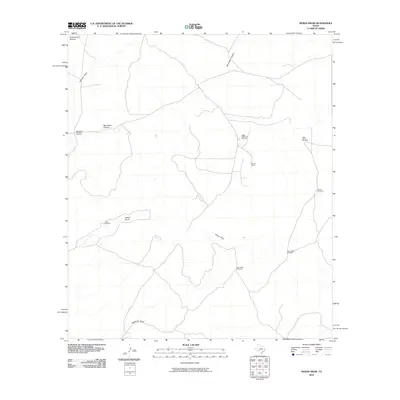
2010 Map of Indian Draw
USGS Topo · Published 2010About this map
Marley Ranch sits within a landscape defined by an extensive network of ephemeral drainages and essential water infrastructure in Val Verde County. The terrain is carved by deep seasonal courses like Big Indian Canyon, Government Canyon, and the central Indian Draw. In this arid environment, the survival of ranching operations is made visible by the numerous named windmills distributed across the territory. Features such as the Big Indian Waterhole Windmill, Indian Waterhole Windmill, and Quien Sabe Windmill demonstrate the reliance on groundwater for livestock in the Texas backcountry. This topography is also marked by the broad paths of Edwards Draw and Johnson Draw, illustrating the complex watershed system that shapes the land use and ranching patterns of the region.
Find a feature on this map
25 named features on this map. Tap any name to fly to it.
Don’t see what you’re looking for? This feature index may not catch every label — zoom into the map to look around manually.
Map Details
Editions of this 2010 Indian Draw Map
This is the sole edition of this map. No revisions or reprints were ever made.
Other maps of this area

1954 · Sonora
USGS Topo · 1:250,000

1958 · Sonora
USGS Topo · 1:250,000

1969 · Wild Horse Canyon
USGS Topo · 1:24,000

1970 · Howards Well NE
USGS Topo · 1:24,000

1970 · Aermotor Draw
USGS Topo · 1:24,000

1970 · Juno
USGS Topo · 1:24,000

1970 · Steel Star Draw
USGS Topo · 1:24,000

1970 · Indian Draw
USGS Topo · 1:24,000

1970 · Bee Canyon
USGS Topo · 1:24,000

1970 · Brushy Draw
USGS Topo · 1:24,000