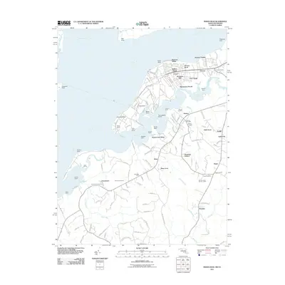
2011 Map of Indian Head
USGS Topo · Published 2011About this map
Indian Head and its sprawling residential additions like Warington Hills and Potomac Wood dominate this Potomac River landscape at the start of the 2010s. The map illustrates a complex coastal geography defined by numerous points and necks, such as Cornwallis Neck and Stump Neck, which extend into the wide waters of the Potomac River and Occoquan Bay. Inland, the settlement pattern is characterized by established communities like Marbury and Pisgah, each anchored by their own post offices and cemeteries.
Find a feature on this map
127 named features on this map. Tap any name to fly to it.
Don’t see what you’re looking for? This feature index may not catch every label — zoom into the map to look around manually.
Map Details
Editions of this 2011 Indian Head Map
This is the sole edition of this map. No revisions or reprints were ever made.
Other maps of this area

1889 · Fredericksburg
USGS Topo · 1:125,000

1890 · Mt. Vernon
USGS Topo · 1:125,000

1891 · Mt. Vernon
USGS Topo · 1:125,000

1892 · Fredericksburg
USGS Topo · 1:125,000

1894 · Fredericksburg
USGS Topo · 1:125,000

1894 · Mt. Vernon
USGS Topo · 1:125,000

1897 · Mt. Vernon
USGS Topo · 1:125,000

1913 · Indian Head
USGS Topo · 1:62,500

1913 · Nanjemoy
USGS Topo · 1:62,500

1923 · Indian Head
USGS Topo · 1:48,000