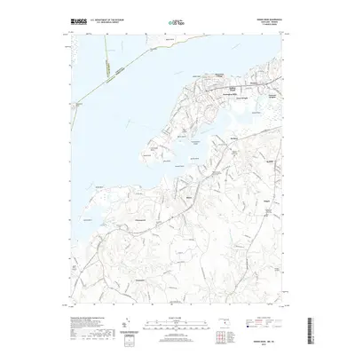
2019 Map of Indian Head
USGS Topo · Published 2019About this map
Indian Head occupies a prominent peninsula along the Potomac River, defined by the deep inlets of Mattawoman Creek and Chicamuxen Creek. This coastal landscape in Charles County features a distinct concentration of small rural communities and family-named terrain, including Cornwallis Neck and Bullitt Neck. The 2019 survey documents a network of inland settlements such as Marbury, Pisgah, and Chicamuxen, each anchored by historical institutions like the Pisgah United Methodist Church Cem and Marbury Baptist Church Cem.
Find a feature on this map
138 named features on this map. Tap any name to fly to it.
Don’t see what you’re looking for? This feature index may not catch every label — zoom into the map to look around manually.
Map Details
Editions of this 2019 Indian Head Map
This is the sole edition of this map. No revisions or reprints were ever made.
Other maps of this area

1889 · Fredericksburg
USGS Topo · 1:125,000

1890 · Mt. Vernon
USGS Topo · 1:125,000

1891 · Mt. Vernon
USGS Topo · 1:125,000

1892 · Fredericksburg
USGS Topo · 1:125,000

1894 · Fredericksburg
USGS Topo · 1:125,000

1894 · Mt. Vernon
USGS Topo · 1:125,000

1897 · Mt. Vernon
USGS Topo · 1:125,000

1913 · Indian Head
USGS Topo · 1:62,500

1913 · Nanjemoy
USGS Topo · 1:62,500

1923 · Indian Head
USGS Topo · 1:48,000