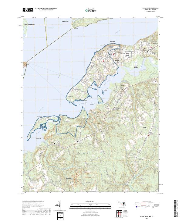
2023 Map of Indian Head
USGS Topo · Published 2023About this map
Indian Head and its surrounding riverine communities occupy a complex landscape where the Potomac River meets winding tributaries like Mattawoman Creek and Chicamuxen Creek. This modern survey reveals a dense concentration of residential developments north of the creek, including Potomac Heights, Warington Hills, and Glymont, while the southern reaches towards Doncaster and Chicamuxen retain a more rural character defined by scattered homesteads and significant ecclesiastical sites.
Find a feature on this map
142 named features on this map. Tap any name to fly to it.
Don’t see what you’re looking for? This feature index may not catch every label — zoom into the map to look around manually.
Map Details
Editions of this 2023 Indian Head Map
This is the sole edition of this map. No revisions or reprints were ever made.
Other maps of this area

1889 · Fredericksburg
USGS Topo · 1:125,000

1890 · Mt. Vernon
USGS Topo · 1:125,000

1891 · Mt. Vernon
USGS Topo · 1:125,000

1892 · Fredericksburg
USGS Topo · 1:125,000

1894 · Fredericksburg
USGS Topo · 1:125,000

1894 · Mt. Vernon
USGS Topo · 1:125,000

1897 · Mt. Vernon
USGS Topo · 1:125,000

1913 · Indian Head
USGS Topo · 1:62,500

1913 · Nanjemoy
USGS Topo · 1:62,500

1923 · Indian Head
USGS Topo · 1:48,000