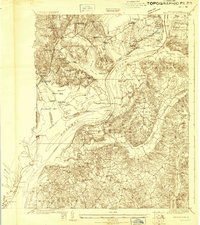
1923 Map of Indian Head
USGS Topo · Published 1923About this map
The Potomac River corridor south of Washington D.C. is shown here during a significant period of military and infrastructure development. The landscape is dominated by heavy coastal defenses and early 20th-century government sites, including Fort Humphreys, Fort Hunt, and the Naval Proving Ground near Glynmont. This survey captures the transition from a river-based economy, with numerous landings like Marshall Hall PO, to a rail and road network represented by the Richmond Washington Highway and the Occoquan Sta railroad connection.
Find a feature on this map
86 named features on this map. Tap any name to fly to it.
Don’t see what you’re looking for? This feature index may not catch every label — zoom into the map to look around manually.
Map Details
Editions of this 1923 Indian Head Map
2 editions found

Other maps of this area

1889 · Fredericksburg
USGS Topo · 1:125,000

1890 · Mt. Vernon
USGS Topo · 1:125,000

1891 · Mt. Vernon
USGS Topo · 1:125,000

1892 · Fredericksburg
USGS Topo · 1:125,000

1892 · Brandywine
USGS Topo · 1:62,500

1894 · Wicomico
USGS Topo · 1:62,500

1894 · Fredericksburg
USGS Topo · 1:125,000

1894 · Mt. Vernon
USGS Topo · 1:125,000

1895 · Wicomico
USGS Topo · 1:62,500

1895 · Brandywine
USGS Topo · 1:62,500