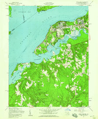
1956 Map of Indian Head
USGS Topo · Published 1959About this map
The Indian Head Powder Factory dominates this mid-century landscape along the Potomac River, reflecting the significant military and industrial presence in Charles County during the 1950s. The sprawling U S Naval Reservation occupies a massive footprint across Cornwallis Neck, Stump Neck, and the adjacent woodlands, defining the local economy and settlement patterns of the era. Beyond the naval works, the map reveals a deeply rooted rural community characterized by a network of small churches and family-named wharves. Places like Chicamuxen, Pisgah, and Marbury serve as anchors for local life, while the dense timber of Doncaster State Forest covers the southern reaches of the quadrangle. Historians can trace the maritime infrastructure of the day through features like Poseys Wharf and Grinders Wharf, which once linked these riverfront communities to the broader Chesapeake trade routes before modern highway expansion.
Find a feature on this map
55 named features on this map. Tap any name to fly to it.
Don’t see what you’re looking for? This feature index may not catch every label — zoom into the map to look around manually.
Map Details
Editions of this 1956 Indian Head Map
This is the sole edition of this map. No revisions or reprints were ever made.
Other maps of this area

1889 · Fredericksburg
USGS Topo · 1:125,000

1890 · Mt. Vernon
USGS Topo · 1:125,000

1891 · Mt. Vernon
USGS Topo · 1:125,000

1892 · Fredericksburg
USGS Topo · 1:125,000

1894 · Fredericksburg
USGS Topo · 1:125,000

1894 · Mt. Vernon
USGS Topo · 1:125,000

1897 · Mt. Vernon
USGS Topo · 1:125,000

1913 · Indian Head
USGS Topo · 1:62,500

1913 · Nanjemoy
USGS Topo · 1:62,500

1923 · Indian Head
USGS Topo · 1:48,000