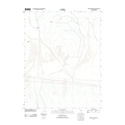
2011 Map of Indian Head Peak
USGS Topo · Published 2011About this map
Indian Head Peak rises as the central topographical feature of this Nevada landscape, commanding a vista over the arid terrain of Mineral County. This 2011 survey documents a geography defined by stark drainage patterns and high-relief landmarks, including Paymaster Canyon and the western descent of Blackrock Gulch. The map illustrates a transitional environment where the high peaks give way to lower alluvial plains, a landscape navigated by utility infrastructure and remote desert tracks. Functional corridors like Powerline Rd and Power Line Rd cross the southern portion of the quadrangle, indicating the modern utility network required to service this sparsely populated region. These labels provide essential reference points for understanding the historical and contemporary movement through this corner of the Great Basin.
Find a feature on this map
5 named features on this map. Tap any name to fly to it.
Don’t see what you’re looking for? This feature index may not catch every label — zoom into the map to look around manually.
Map Details
Editions of this 2011 Indian Head Peak Map
This is the sole edition of this map. No revisions or reprints were ever made.
Other maps of this area

1909 · Hawthorne
USGS Topo · 1:250,000

1911 · Hawthorne
USGS Topo · 1:250,000

1915 · Hawthorne
USGS Topo · 1:250,000

1948 · Walker Lake
USGS Topo · 1:250,000

1957 · Walker Lake
USGS Topo · 1:250,000

1962 · Walker Lake
USGS Topo · 1:250,000

1964 · Walker Lake
USGS Topo · 1:250,000

1967 · Pamlico
USGS Topo · 1:24,000

1967 · Mina NW
USGS Topo · 1:24,000
1967 · Mable Mountain
USGS Topo · 1:24,000