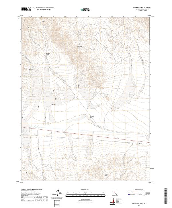
2021 Map of Indian Head Peak
USGS Topo · Published 2021About this map
Indian Head Peak rises as a prominent landmark within the northern reaches of the Gillis Range, defining a landscape of high desert terrain in Mineral County. To the south, the Garfield Hills frame the broad expanse of Soda Spring Valley, a region characterized by its drainage patterns and alluvial fans. The map reveals the logistical infrastructure of the modern West, specifically the presence of Power Line Rd which traverses the valley floor, cutting across the established section lines of the Public Land Survey System. Drainage features such as Paymaster Canyon and Blackrock Gulch illustrate the erosional forces at work near Martinez Hill. This 2021 survey provides a clear look at the topographic relief between the peaks and the valley basins, detailing the complex network of ephemeral washes that feed into the central sink.
Find a feature on this map
14 named features on this map. Tap any name to fly to it.
Don’t see what you’re looking for? This feature index may not catch every label — zoom into the map to look around manually.
Map Details
Editions of this 2021 Indian Head Peak Map
This is the sole edition of this map. No revisions or reprints were ever made.
Other maps of this area

1909 · Hawthorne
USGS Topo · 1:250,000

1911 · Hawthorne
USGS Topo · 1:250,000

1915 · Hawthorne
USGS Topo · 1:250,000

1948 · Walker Lake
USGS Topo · 1:250,000

1957 · Walker Lake
USGS Topo · 1:250,000

1962 · Walker Lake
USGS Topo · 1:250,000

1964 · Walker Lake
USGS Topo · 1:250,000

1967 · Pamlico
USGS Topo · 1:24,000

1967 · Mina NW
USGS Topo · 1:24,000
1967 · Mable Mountain
USGS Topo · 1:24,000