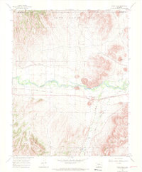
1966 Map of Indian Head
USGS Topo · Published 1968About this map
The Rio Grande winds through this mid-1960s landscape, marking the transition between the valley floor and the wooded slopes of the Rio Grande National Forest. The prominent landmark of Indian Head overlooks the river corridor, where the Denver and Rio Grande Western railroad parallels the water's path through the small settlement of Hanna. The map illustrates a landscape of working water and infrastructure, featuring the State Bridge, a Gaging Sta, and multiple water sources like Old Woman Creek and Pinos Cr.
Find a feature on this map
22 named features on this map. Tap any name to fly to it.
Don’t see what you’re looking for? This feature index may not catch every label — zoom into the map to look around manually.
Map Details
Editions of this 1966 Indian Head Map
3 editions found
Other maps of this area

1914 · Creede
USGS Topo · 1:125,000

1915 · Del Norte
USGS Topo · 1:125,000

1916 · Creede
USGS Topo · 1:125,000

1917 · Del Norte
USGS Topo · 1:125,000

1945 · Durango
USGS Topo · 1:250,000

1953 · Durango
USGS Topo · 1:250,000

1954 · Durango
USGS Topo · 1:250,000

1961 · Durango
USGS Topo · 1:250,000

1963 · Durango
USGS Topo · 1:250,000

1966 · Durango
USGS Topo · 1:250,000