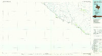
1984 Map of Indian Hot Springs
USGS Topo · Published 1985About this map
Indian Hot Springs sits as a primary destination along the northern bank of the Rio Grande, marking a sparsely populated stretch of the Trans-Pecos where water dictates the location of every human outpost. This 1984 planimetric study reveals a landscape dominated by the Quitman Mountains and Eagle Mountains, where isolated water sources like Eagle Spring, Deer Spring, and Red Bull Spring provide critical landmarks. The map tracks the winding international border between the United States and Mexico, defined by the river’s course through Hudspeth County. Movement through the desert is traced by a network of Jeep Trails connecting remote catchments such as Adobe Tank and Middle Tank. Landforms like The Palisades and peaks such as Eagle Peak and Panther Peak provide dramatic vertical relief against the wide drainages of Hackberry Draw and Davis Draw.
Find a feature on this map
40 named features on this map. Tap any name to fly to it.
Don’t see what you’re looking for? This feature index may not catch every label — zoom into the map to look around manually.
Map Details
Editions of this 1984 Indian Hot Springs Map
This is the sole edition of this map. No revisions or reprints were ever made.
Other maps of this area

1892 · Chispa
USGS Topo · 1:125,000

1894 · Fort Hancock
USGS Topo · 1:125,000

1895 · Chispa
USGS Topo · 1:125,000

1895 · Sierra Blanca
USGS Topo · 1:125,000

1896 · San Carlos
USGS Topo · 1:125,000

1896 · Rio Grande
USGS Topo · 1:125,000

1897 · Eagle Mountain
USGS Topo · 1:125,000

1897 · Chispa
USGS Topo · 1:125,000

1906 · Van Horn
USGS Topo · 1:125,000

1916 · Eagle Mountain
USGS Topo · 1:125,000