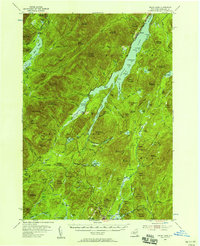
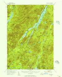
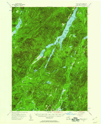
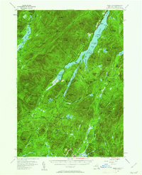
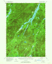
1954 Map of Indian Lake
USGS Topo · Published 1958About this map
Indian Lake dominates the central portion of this 1950s terrain, with the The Narrows leading north past Sabael. The landscape reflects a mix of early resort development and logging history, anchored by the village of Speculator in the south near Sacandaga Lake. The area's status as a managed wilderness is evident in the network of remote camps and clearings, such as Camp No 22, Perkins Clearing, and Perrys Clearing, which are connected by primitive routes like the Military Road.
Find a feature on this map
130 named features on this map. Tap any name to fly to it.
Don’t see what you’re looking for? This feature index may not catch every label — zoom into the map to look around manually.
Map Details
Editions of this 1954 Indian Lake Map
6 editions found
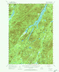
Other maps of this area

1898 · Newcomb
USGS Topo · 1:62,500

1898 · Thirteenth Lake
USGS Topo · 1:62,500

1899 · Indian Lake
USGS Topo · 1:62,500

1900 · Canada Lake
USGS Topo · 1:62,500

1901 · Newcomb
USGS Topo · 1:62,500

1902 · Indian Lake
USGS Topo · 1:62,500

1903 · West Canada Lakes
USGS Topo · 1:62,500

1903 · Raquette Lake
USGS Topo · 1:62,500

1903 · Blue Mountain
USGS Topo · 1:62,500

1904 · Piseco Lake
USGS Topo · 1:62,500