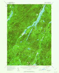
1954 Map of Indian Lake
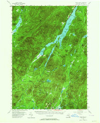
USGS Topo · Published 1973About this map
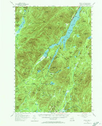
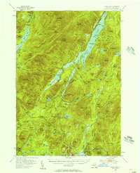
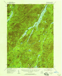
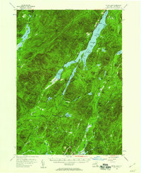
Indian Lake and the surrounding Adirondack High Peaks region are documented here in the mid-1950s, showing a landscape defined by expansive water bodies and remote forest clearings. The hamlet of Sabael sits on the western shore of the main lake, while further south, the village of Speculator provides a hub near Sacandaga Lake and Christine Falls. This area serves as a critical watershed, with the Miami River, Jessup River, and Cedar River carving through the mountain passes.
Find a feature on this map
135 named features on this map. Tap any name to fly to it.
Don’t see what you’re looking for? This feature index may not catch every label — zoom into the map to look around manually.
Map Details
Editions of this 1954 Indian Lake Map
6 editions found
Other maps of this area

1898 · Newcomb
USGS Topo · 1:62,500

1898 · Thirteenth Lake
USGS Topo · 1:62,500

1899 · Indian Lake
USGS Topo · 1:62,500

1900 · Canada Lake
USGS Topo · 1:62,500

1901 · Newcomb
USGS Topo · 1:62,500

1902 · Indian Lake
USGS Topo · 1:62,500

1903 · West Canada Lakes
USGS Topo · 1:62,500

1903 · Raquette Lake
USGS Topo · 1:62,500

1903 · Blue Mountain
USGS Topo · 1:62,500

1904 · Piseco Lake
USGS Topo · 1:62,500