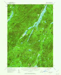
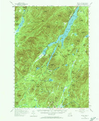
1954 Map of Indian Lake
USGS Topo · Published 1962About this map
Indian Lake and the Sacandaga River dominate this mid-century survey of Hamilton County, showcasing a landscape defined by deep Adirondack wilderness and secluded outposts. The village of Speculator stands at the southern edge near the Fish Hatchery, while the settlement of Sabael occupies the western shore of the main lake. High-elevation vantage points like the Snowy Mountain Lookout Tower and Blue Ridge overlook a network of backcountry trails and primitive clearings such as Perkins Clearing and Indian Clearing. These named clearings and remote camps, including Camp No 22 and Camp No 19, hint at the area's history of timber harvesting and seasonal habitation. Water remains the primary connective tissue of the region, from the expansive John Mack Bay to the smaller, high-mountain basins of Lewey Lake and Whitaker Lake.
Find a feature on this map
128 named features on this map. Tap any name to fly to it.
Don’t see what you’re looking for? This feature index may not catch every label — zoom into the map to look around manually.
Map Details
Editions of this 1954 Indian Lake Map
6 editions found

Other maps of this area

1898 · Newcomb
USGS Topo · 1:62,500

1898 · Thirteenth Lake
USGS Topo · 1:62,500

1899 · Indian Lake
USGS Topo · 1:62,500

1900 · Canada Lake
USGS Topo · 1:62,500

1901 · Newcomb
USGS Topo · 1:62,500

1902 · Indian Lake
USGS Topo · 1:62,500

1903 · West Canada Lakes
USGS Topo · 1:62,500

1903 · Raquette Lake
USGS Topo · 1:62,500

1903 · Blue Mountain
USGS Topo · 1:62,500

1904 · Piseco Lake
USGS Topo · 1:62,500