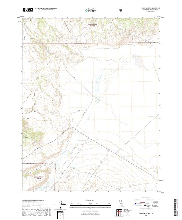
2021 Map of Indian Meadows
USGS Topo · Published 2021About this map
Adobe Valley and the surrounding high-desert basin of Mono County are defined by a complex network of seasonal drainages and topographic landmarks. Within the Inyo National Forest, the terrain rises toward Granite Mtn and the Adobe Hills, where the landscape is carved by North Canyon and Taylor Canyon. The hydrology of this arid region is centered on the Adobe Reservoir and several vital watercourses, including Adobe Cr, McGee Cr, and Dexter Cr.
Find a feature on this map
23 named features on this map. Tap any name to fly to it.
Don’t see what you’re looking for? This feature index may not catch every label — zoom into the map to look around manually.
Map Details
Editions of this 2021 Indian Meadows Map
This is the sole edition of this map. No revisions or reprints were ever made.
Other maps of this area

1909 · Hawthorne
USGS Topo · 1:250,000

1911 · Hawthorne
USGS Topo · 1:250,000

1914 · Mt. Morrison
USGS Topo · 1:125,000

1915 · Hawthorne
USGS Topo · 1:250,000

1947 · Mariposa
USGS Topo · 1:250,000

1948 · Walker Lake
USGS Topo · 1:250,000

1948 · Mariposa
USGS Topo · 1:250,000

1957 · Walker Lake
USGS Topo · 1:250,000

1957 · Mariposa
USGS Topo · 1:250,000

1958 · Trench Canyon
USGS Topo · 1:62,500