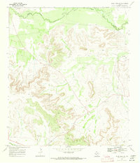
1969 Map of Indian Mesa NE
USGS Topo · Published 1973About this map
The Pecos River winds along the northern boundary of this West Texas landscape, marking the historic divide between Crockett Co and Pecos Co. Surveyed in the late 1960s, the terrain is dominated by the massive formation of Indian Mesa, where steep contour lines reveal the deep draws and escarpments characteristic of the Trans-Pecos region. Human activity is defined by the energy and ranching industries, centered on the Toborg Oil Field and the isolated Wilson Ranch.
Find a feature on this map
14 named features on this map. Tap any name to fly to it.
Don’t see what you’re looking for? This feature index may not catch every label — zoom into the map to look around manually.
Map Details
Editions of this 1969 Indian Mesa NE Map
This is the sole edition of this map. No revisions or reprints were ever made.
Other maps of this area

1928 · Crane
USGS Topo · 1:125,000

1928 · Rankin
USGS Topo · 1:125,000

1929 · Sheffield
USGS Topo · 1:125,000

1929 · Independence Draw Quadrangle
USGS Topo · 1:125,000

1954 · Pecos
USGS Topo · 1:250,000

1954 · Fort Stockton
USGS Topo · 1:250,000

1954 · Sonora
USGS Topo · 1:250,000

1954 · San Angelo
USGS Topo · 1:250,000

1957 · Pecos
USGS Topo · 1:250,000

1958 · Sonora
USGS Topo · 1:250,000