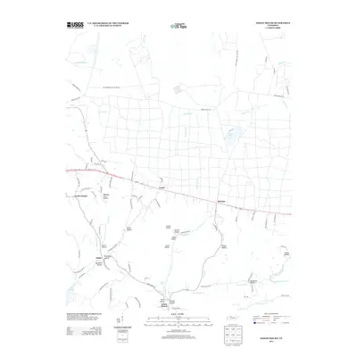
2013 Map of Indian Mound
USGS Topo · Published 2013About this map
Indian Mound and the surrounding Stewart County countryside are defined by a complex network of stream-carved hollows and agricultural plateaus. The landscape is characterized by its deep-set drainages, including Weakley Horn Hollow, Smith Hollow, and Gillum Hollow, which feed into major water bodies like North Cross Cr and the eastern edge of Lake Barkley. This 2013 survey illustrates the modern road network connecting established local settlements such as Legate, Red Top, and Atkins. The northern portion of the quadrangle is largely occupied by the Fort Campbell Military Res, reflecting the intersection of civilian life and military land use. Notable landmarks like Lake Kyle and Wyatts Chapel provide touchstones for local history and community geography, while named water features like Piney Fork and Dicks Fork Cr trace the natural topography of the region.
Find a feature on this map
86 named features on this map. Tap any name to fly to it.
Don’t see what you’re looking for? This feature index may not catch every label — zoom into the map to look around manually.
Map Details
Editions of this 2013 Indian Mound Map
This is the sole edition of this map. No revisions or reprints were ever made.
Other maps of this area

1931 · Erin
USGS Topo · 1:62,500

1936 · Dover
USGS Topo · 1:24,000

1950 · Dover
USGS Topo · 1:24,000

1951 · Roaring Spring
USGS Topo · 1:24,000

1951 · Johnson Hollow
USGS Topo · 1:24,000

1951 · Indian Mound
USGS Topo · 1:24,000

1951 · Bumpus Mills
USGS Topo · 1:24,000

1951 · Herndon
USGS Topo · 1:24,000

1951 · Woodlawn
USGS Topo · 1:24,000

1956 · Nashville
USGS Topo · 1:250,000