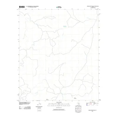
2010 Map of Indian Mountain
USGS Topo · Published 2010About this map
Indian Mountain and Black Mountain anchor this high-elevation landscape in Edwards County, where the topography is defined by a network of drainage systems feeding into the Rio Grande basin. The presence of Stagecoach Waterhole suggests a historical reliance on specific water points for transit through this arid Texas region, likely serving as a critical stop for early travelers and livestock. The area's limited infrastructure is represented by Co Rd 17, which winds through a terrain deeply etched by seasonal watercourses like Bluff Creek, Cherry Creek, and Dry Sycamore Creek. These features illustrate the traditional ranching geography of the Southwest, where land use and movement are dictated by the presence of natural springs and the winding paths of dry creek beds.
Find a feature on this map
9 named features on this map. Tap any name to fly to it.
Don’t see what you’re looking for? This feature index may not catch every label — zoom into the map to look around manually.
Map Details
Editions of this 2010 Indian Mountain Map
This is the sole edition of this map. No revisions or reprints were ever made.
Other maps of this area

1893 · Nueces
USGS Topo · 1:125,000

1896 · Nueces
USGS Topo · 1:125,000

1944 · Barksdale
USGS Topo · 1:62,500

1944 · Indian Creek
USGS Topo · 1:62,500

1944 · Indian Mountain
USGS Topo · 1:62,500

1947 · Hackberry
USGS Topo · 1:62,500

1958 · Del Rio
USGS Topo · 1:250,000

1964 · Del Rio
USGS Topo · 1:250,000
1967 · Indian Mountain
USGS Topo · 1:24,000
1974 · Twomile Draw
USGS Topo · 1:24,000