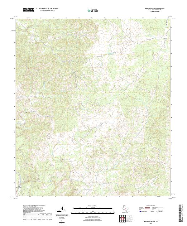
2022 Map of Indian Mountain
USGS Topo · Published 2022About this map
Indian Mtn and Black Mtn anchor this high-elevation landscape in Edwards County, where the topography is defined by a complex network of seasonal drainage channels and vital water sources. The importance of water in this semi-arid region is evident through named features like Stagecoach Waterhole, Pecan Springs, and Cherry Spring, which historically supported movement through these draws. Civil infrastructure is sparse, characterized primarily by Co RD 17 and Co RD 201 winding through the terrain. The presence of the Pinon Ranch Airport in the southwest corner suggests the modern reliance on private aviation for accessing these large ranch holdings. The map traces the upper reaches of Dry Sycamore Cr and several other creeks like Cave Cr and Bluff Cr, illustrating how the land naturally funnels toward larger regional watersheds.
Find a feature on this map
14 named features on this map. Tap any name to fly to it.
Don’t see what you’re looking for? This feature index may not catch every label — zoom into the map to look around manually.
Map Details
Editions of this 2022 Indian Mountain Map
This is the sole edition of this map. No revisions or reprints were ever made.
Other maps of this area

1893 · Nueces
USGS Topo · 1:125,000

1896 · Nueces
USGS Topo · 1:125,000

1944 · Barksdale
USGS Topo · 1:62,500

1944 · Indian Creek
USGS Topo · 1:62,500

1944 · Indian Mountain
USGS Topo · 1:62,500

1947 · Hackberry
USGS Topo · 1:62,500

1958 · Del Rio
USGS Topo · 1:250,000

1964 · Del Rio
USGS Topo · 1:250,000
1967 · Indian Mountain
USGS Topo · 1:24,000
1974 · Twomile Draw
USGS Topo · 1:24,000