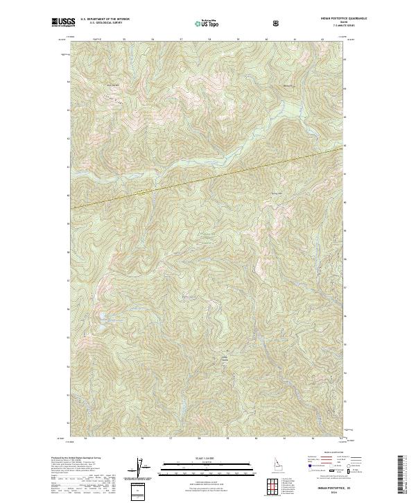
2024 Map of Indian Postoffice
USGS Topo · Published 2024About this map
Lolo Trl winds through the high ridges of the Clearwater National Forest, tracing a corridor of immense historical significance for navigation across the Bitterroot Range. This contemporary survey of the Indian Postoffice quadrangle captures the complex hydrography and topography of the borderlands between Clearwater Co and Idaho Co. Steep drainages like Cayuse Creek and Postoffice Creek define the landscape, radiating from prominent high points such as Spring Mtn and Lunde Ridge. The map details the network of Forest Service access, including Doe Creek Rd and Nat For Dev Rd 565, which navigate the elevation changes near Deep Saddle. Remote water features like Indian Postoffice Lake and the West Fork Waw'aalamnime Creek emphasize the primitive character of this protected wilderness area.
Find a feature on this map
32 named features on this map. Tap any name to fly to it.
Don’t see what you’re looking for? This feature index may not catch every label — zoom into the map to look around manually.
Map Details
Editions of this 2024 Indian Postoffice Map
This is the sole edition of this map. No revisions or reprints were ever made.
Other maps of this area

1911 · Lolo
USGS Topo · 1:250,000

1913 · Lolo
USGS Topo · 1:250,000

1956 · Hamilton
USGS Topo · 1:250,000

1959 · Hamilton
USGS Topo · 1:250,000

1960 · Hamilton
USGS Topo · 1:250,000

1964 · Hamilton
USGS Topo · 1:250,000

1965 · Gorman Hill
USGS Topo · 1:24,000

1965 · Horseshoe Lake
USGS Topo · 1:24,000
1966 · Rhodes Peak
USGS Topo · 1:24,000
1966 · Bear Mountain
USGS Topo · 1:24,000