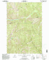
1994 Map of Indian Postoffice
USGS Topo · Published 1997About this map
The Indian Postoffice rock cairns stand as a prominent high-point landmark in this remote section of the Clearwater National Forest. Straddling the boundary between Clearwater County and Idaho County, the terrain is defined by the high elevations of Lunde Ridge and the drainage basins of Cayuse Creek and Postoffice Creek. This 1994 revision by the U.S. Forest Service identifies significant cultural and historical sites, most notably the Ne-Me-Poo (Nez Perce) National Historic Trail as it traverses the ridge lines.
Find a feature on this map
22 named features on this map. Tap any name to fly to it.
Don’t see what you’re looking for? This feature index may not catch every label — zoom into the map to look around manually.
Map Details
Editions of this 1994 Indian Postoffice Map
This is the sole edition of this map. No revisions or reprints were ever made.
Other maps of this area

1911 · Lolo
USGS Topo · 1:250,000

1913 · Lolo
USGS Topo · 1:250,000

1956 · Hamilton
USGS Topo · 1:250,000

1959 · Hamilton
USGS Topo · 1:250,000

1960 · Hamilton
USGS Topo · 1:250,000

1964 · Hamilton
USGS Topo · 1:250,000

1965 · Gorman Hill
USGS Topo · 1:24,000

1965 · Horseshoe Lake
USGS Topo · 1:24,000
1966 · Rhodes Peak
USGS Topo · 1:24,000
1966 · Bear Mountain
USGS Topo · 1:24,000