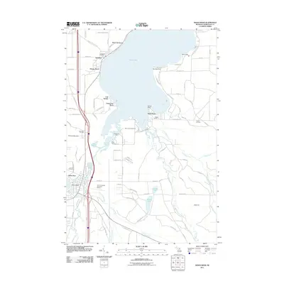
2011 Map of Indian River
USGS Topo · Published 2011About this map
Mullett Lake and its western shore dominate this landscape, where the lakefront communities of Topinabee and Royal Oak Beach sit along the narrow strip between the water and the rising terrain of Griswold Mountain. The southern end of the map reveals a complex network of waterways, where the Indian River connects Burt Lake to the larger Mullett Lake. This area serves as a significant central point for local activity, anchored by the Indian River Post Office and the Calvin Campbell Municipal Airport.
Find a feature on this map
107 named features on this map. Tap any name to fly to it.
Don’t see what you’re looking for? This feature index may not catch every label — zoom into the map to look around manually.
Map Details
Editions of this 2011 Indian River Map
This is the sole edition of this map. No revisions or reprints were ever made.
Other maps of this area

1955 · Cheboygan
USGS Topo · 1:250,000

1957 · Tower
USGS Topo · 1:62,500

1957 · Wolverine
USGS Topo · 1:62,500

1957 · Cheboygan
USGS Topo · 1:62,500

1957 · Mullett Lake
USGS Topo · 1:62,500

1958 · Cheboygan
USGS Topo · 1:250,000

1982 · Petoskey
USGS Topo · 1:100,000

1982 · Aloha
USGS Topo · 1:25,000
1982 · Indianville
USGS Topo · 1:25,000
1982 · Mullett Lake
USGS Topo · 1:25,000