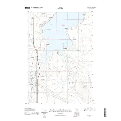
2019 Map of Indian River
USGS Topo · Published 2019About this map
Indian River and the neighboring settlements along the shores of Mullett Lake and Burt Lake are captured here in the late 2010s. The landscape is defined by the narrow waterways connecting these large bodies of water, which served as vital corridors long before modern development. In the northern section, the community of Topinabee is centered along the shoreline, while several smaller beach developments like Giauque Beach and Royal Oak Beach dot the coast. The mapping reveals a detailed transportation network, including the N Central State Trail, which follows the historic path of the railway along the western edge of Mullett Lake. Further south, the map details the convergence of the Sturgeon River and the Indian River, highlighting the local importance of water access for recreation and regional travel. Genealogists will find the locations of Oak Hill Cem and Koehler Cem particularly useful for identifying family sites near these historic lakeside communities.
Find a feature on this map
169 named features on this map. Tap any name to fly to it.
Don’t see what you’re looking for? This feature index may not catch every label — zoom into the map to look around manually.
Map Details
Editions of this 2019 Indian River Map
This is the sole edition of this map. No revisions or reprints were ever made.
Other maps of this area

1955 · Cheboygan
USGS Topo · 1:250,000

1957 · Tower
USGS Topo · 1:62,500

1957 · Wolverine
USGS Topo · 1:62,500

1957 · Cheboygan
USGS Topo · 1:62,500

1957 · Mullett Lake
USGS Topo · 1:62,500

1958 · Cheboygan
USGS Topo · 1:250,000

1982 · Petoskey
USGS Topo · 1:100,000

1982 · Aloha
USGS Topo · 1:25,000
1982 · Indianville
USGS Topo · 1:25,000
1982 · Mullett Lake
USGS Topo · 1:25,000