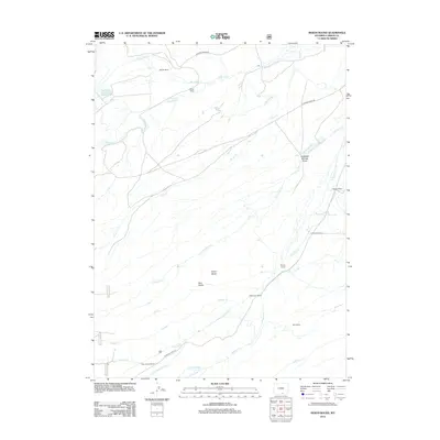
2012 Map of Indian Rocks
USGS Topo · Published 2012About this map
Indian Rocks stands as a prominent landmark in this high-altitude Carbon County landscape, where water management and ranching define the human footprint. The map reveals a complex network of irrigation infrastructure, including the Cherokee Ditch, Centennial Ditch, and Dunkard Ditch, designed to divert water from the numerous seasonal and perennial creeks like N Spring Cr and Snow Cr to sustain local agriculture.
Find a feature on this map
31 named features on this map. Tap any name to fly to it.
Don’t see what you’re looking for? This feature index may not catch every label — zoom into the map to look around manually.
Map Details
Editions of this 2012 Indian Rocks Map
This is the sole edition of this map. No revisions or reprints were ever made.
Other maps of this area

1932 · Savery
USGS Topo · 1:96,000

1939 · Saratoga
USGS Topo · 1:125,000

1940 · Savery
USGS Topo · 1:125,000

1954 · Rawlins
USGS Topo · 1:250,000

1958 · Rawlins
USGS Topo · 1:250,000

1961 · Red Mountain
USGS Topo · 1:24,000

1961 · Bridger Peak
USGS Topo · 1:24,000

1961 · Encampment
USGS Topo · 1:24,000

1961 · Jack Creek Reservoir
USGS Topo · 1:24,000
1961 · Saratoga
USGS Topo · 1:24,000